Blog

Kintail wanderings: 9 Munros north of Glen Shiel
A long day's walking over multiple Munros in Kintail in the North-West Highlands of Scotland.

Looking back to the summit of Sgurr Fhuaran, the last of day’s nine Munros north of Glen Shiel in Scotland
Recently, I was preparing a stripped down photography equipment list for occasions where I wanted to travel light outdoors but still needed to capture professional-quality images. Although the items of equipment I chose are lighter than my full bag of camera and lighting gear, they are still too heavy for me to carry on occasions when I’m not working and my goal is to push myself a little in the mountains.
My inspiration for challenging days out on the hills comes from the athletes I photograph as well as my friends. I’m nowhere near a mountain runner or fell runner but I’ve had plenty of photography shoots with professional runners (and follow their adventures online) and the ease and speed at which they travel over rough ground has made me realise that I enjoy moving quicker than walking speed in the mountains (something which I have attempted to do in the past with a full camera backpack but my lower back seeks to constantly remind me).
With this in mind, I purchased the lightest-weight camera I own, a Sony RX100 V for outdoor adventures for occasions where photography is not the focus of my trip but I still wish to capture decent-quality images. The images I’m able to produce with the Sony RX100 are on the borderline of what I’d class as being acceptable for professional purposes (I’m happy to use them for editorial submissions, social media posts and blogs) but the trade off when I’m not working is immeasurable. I can fit the camera into a stretchy front pocket of my backpack and easily fast-walk or jog with it up and down hills without any impairment on my activity, whilst still being able to document my day or take shots I can use later for e.g. location scouting purposes.
The type of outing I’d carry along a Sony RX100 on would be trail running in my local Pentland Hills, a multi-Munro route like the one described here, a hut-to-hut run in the European Alps or a long-distance mountain bike time trial, where my objective is to achieve a relatively big thing (for me) in a certain period of time and I don’t wish to be encumbered with a heavy pack.
An example of this was when I was looking for ideas for a challenging day out in Scotland. My focus was on Kintail in the North-West Highlands of Scotland. If I wished to climb a lot of Munros in a day, Kintail’s South Glen Shiel ridge allows for 7 summits to be ticked off in a fairly easy fashion. Opposite them on the north side of the glen, there are 7 Munros that I could do the following day (or perhaps even on the same day).
The record for the most amount of Munros in a day is held by English runner Kim Collison, who ran 100 miles and climbed 29,500ft to tick off a total of 33 summits in 23 hours and 59 minutes in 2021. The record for total Munro completions overall is Steven Fallon, who’s completed 15 rounds (of 282 hills, sometimes more) over a twenty year period. A qualified mountain guide, Steven is also an accomplished hill runner and his website has a number of running options if you’re looking to join groups of Munros together to make a longer day and set yourself a challenge.
I settled on Steven Fallon’s Kintail Sisters and Brother route, a 39km circular route with c.4000m ascent that includes two nearby Munros and takes in 9 Munro summits. The route starts and ends at the outdoor centre at Morvich and my goal was to complete the round in a certain timescale, using some adjustments I prefer to Naesmith’s formula (which I calculate at 4km/h for every km travelled and 1 hour for every 600m ascent). This isn’t running pace but to achieve it means not stopping so I figured it was a good enough challenge and it would provide me with a day out that would test me but not break my legs (figuratively speaking, not literally). In the end, I didn’t quite manage to complete the route in Naesmith’s timings (it took me 16 hours instead of 15) but I still felt in great shape at the end and it was a memorable day out.
Glen Shiel Sisters and Brothers route (including two additional Munros)
Distance: 39km / 24 miles
Ascent: 4105m / 13,467ft
Time: 16 hours 03 minutes
(Steven’s website recorded this route as 35km / 22 miles in distance with 3,140m / 10,300ft ascent but my calculations were as above, which I corroborated with a friend and then Steven afterwards).
Munros climbed
A'Ghlas Bheinn (918m)
Beinn Fhada (1032m)
Ciste Dhubh (979m)
Aonach Meadhoin (1001m)
Sgurr a'Bhealaich Dheirg (1036m)
Saileag (956m)
Sgurr na Ciste Duibhe (1027m)
Sgurr na Carnach (1002m)
Sgurr Fhuaran (1067m)


Postscript
One of the reasons I wanted to attempt Steven’s Kintail route was because I have an itch to attempt Philip Tranter’s Round and the time I took in Glen Shiel would give me an indication if that was feasible. It’s relatively tight, with an additional 5 miles and 8,000ft I’d need to cover in the remaining 8 hours (which sounds straightforward enough but at my pace, which will no doubt be slowing by then, it only gives me one hour to play with).

Trail and hill running routes: Edinburgh’s Pentland Hills
A selection of trail and hill running routes, plus photographs, for Pentland Hills Regional Park near Edinburgh in Scotland.
A selection of routes in the hills near Edinburgh that I’ve enjoyed for trail or hill running. They’re perfectly good ideas for walking trips too.
Update July 2025 - I no longer live in Edinburgh so unfortunately there won’t be any new routes added.

A panorama of Turnhouse Hill, Carnethy, Scald Law, South Black Hill, East and West Kip from Castlelaw Hill. (View larger). See more Pentlands photos at the foot of this page.
The Pentland Hills in Scotland are a collection of small hills above Edinburgh in the north and Penicuik in the south. Generally around 500m in altitude (the highest peak is Scald Law at 579m high), they’re not overly big but there’s commonly c.100m ascent and descent between their summits, providing ideal opportunities if you’re wanting to keep hill fit or if you’re training for Scotland’s bigger hills.
Despite being born in Edinburgh, having stayed in the city all my life and generally always been keen on outdoor activity, I’d spent only a tiny amount of time in the Pentlands prior to the Coronavirus pandemic in 2020/21. My preference was to sit indoors on a Wattbike for local exercise and venture further afield to the Scottish Highlands for my hiking, mountain biking and trail running activities. During the Coronavirus-induced lockdowns, and continuing thereafter, that changed and I’ve visited Pentland Hills Regional Park often, on occasion 2–3 times a week, usually later in the evening or after dark, when it’s nice and quiet and very peaceful. (My past lack of interest doesn’t apply to the rest of Edinburgh and the peaks get fairly busy at popular times).
Listed below is a variety of trail and hill running (aka walking / jogging) routes I like to repeat in the Pentlands. For detailed route planning plus navigation, I’d recommend Pentlands Superwalker XT25 or Pentlands Ultramap XT40 maps from Harvey Maps. If you use Strava, the summitbag.com plugin by Phil Bellamy tracks the hills you’ve climbed and totals up your ascent over time.
Entry points to the Pentland Hills
Click the below to expand and view route choices.
-
Getting there - Follow the A702 road south of Edinburgh to Flotterstone Inn. Turn right and drive past the inn to the car park. (Google Maps). The 101/ 102 Edinburgh to Dumfries bus from Houston Coaches stops opposite the inn.
Walking / running routes -
Flotterstone to Turnhouse, Carnethy, Scald Law, South Black Hill, East and West Kip before descending to the drove road past West Kip and then return — c.15km and 1200m ascent (View on Strava)
Flotterstone to the bealach before Scald Law, traversing down to Green Cleugh via the tree plantation, then up and along the side of Black Hill and over Bell’s Hill before descending Maiden’s Cleugh to reach Glencorse reservoir — c.14km and 750m ascent
Alternative - As above over Bell’s Hill but at the top of Maiden’s Cleugh head NW instead towards Harlaw on a good track. Go through a gate and then head immediately NNW to reach the road just E of Wester Kinleith (there’s a path through the woods alongside the track). Head NE on the road towards Middle Kinleith and look for the sign for Poet’s Glen. Descend that to Blinkbonny and onwards to A70 Lanark Road to finish — 15.5km and 660m ascent (View on Strava)
Flotterstone to Carnethy then continue onto the bealach before Scald Law and descend via the tree plantation to Green Cleugh. Head up the steep slopes of Black Hill (after the Pinnacle and opposite the waterfall) then descend NE from Black Hill summit to reach the bealach before Bell’s Hill. Follow the track SE to Glencorse reservoir and then take either the road back to the start or, not far past Glen Cottage, cross through a wall onto a track that goes to the filter beds and return via the start of the Scald Law route — 13km and 730m ascent
Flotterstone first to Castlelaw and then over to Allermuir. Head W to Capelaw and climb Harbour Hill and Bell’s Hill before climbing the long SW flank of Black Hill. Descend the long track from Black Hill summit to the road by Logan Burn and return to Flotterstone — 16.5km and 900m ascent (View on Strava)
-
Getting there - Follow Colinton Road out of Edinburgh city centre. Just before Colinton village, head left, following the signs for Pentland Hills Regional Park, then go uphill past Bonaly Shop to the car park at the end of the road. (Google Maps). Public transport-wise, the number 10 bus from Lothian Buses takes you closest, opposite Bonaly Shop.
Walking / running routes -
From Bonaly Tower ascend Scaletrix to Bonaly Reservoir. Climb Capelaw Hill and Castlelaw before descending to Glencorse and returning to Bonaly via Maiden’s Cleugh and Harbour Hill (or sometimes just Phantom’s Cleugh) — c.15km and 620m ascent
Repeat the above up until Maiden’s Cleugh but then descend first NW and then NNW to Kinleith buildings and then return to Bonaly via Clubbiedean and Torduff reservoirs — c.17km and 510m ascent
From Bonaly car park choose either Scalextrix or the track directly uphill through the woods to reach Bonaly reservoir. Ascend Capelaw Hill then Allermuir and Caerketton. From Caerketton’s summit, head shortly E to join a track that traverses SSE then SSW around Caerketton’s southern slopes, past Boghall Farm and the Tytler Memorial Cross, to reach Castlelaw car park. Decend from the car park to Glencorse reservoir and then ascend Maiden’s Cleugh for the return to Bonaly — c.18.5km and 790m ascent (View on Strava)
From Bonaly shops, head past the Scout Centre to the second car park. Continue uphill towards Bonaly reservoir but take the first right and then left S of Torduff and ascend through the woods to reach the foot of Scaletrix. Continue up Scaletrix and turn right through the gate and onwards to ascend Harbour Hill. From the summit, continue SE on a very runnable grassy track to reach Glencorse reservoir. Touch the gate and then turn around and take the track NW up Maiden’s Cleugh. At the next gate, either ascend Harbour Hill again for a return to Bonaly or continue NW and then W into Balerno or NW and then N to Wester Kinleith and into Currie, the latter recommended via Poet’s Glen — c.11.5km and 400m ascent (View on Strava)
As above to Harbour Hill but continue SE and then SW to the top of Maiden's Cleugh. Continue SE on often wet ground to climb Bell's Hill and then descend first NW then SW on steep, grassy ground (which can slippy lower down, when wet). Don't ascend Black Hill but take the track SE towards Glencorse reservoir. Follow the road around, past the farm and the first gate (which leads up Maiden's Cleugh). Continue along the road with the reservoir on your right and a walled field on your left until you reach a wooded area on your left. Go through the small second gate at these woods and ascend to reach a second gate. Turn right for 50 yards and then ascend steeply NE up the SW slopes of Castlelaw. Descend towards Allermuir but trend left to the reach foot of Capelaw Hill. Climb this and then continue SW and then N to return to Bonaly — c.13.5km and 630m ascent (View on Strava)
-
Getting there - Take the Lanark Road out of Edinburgh to Balerno and follow the signs to Threipmuir reservoir. (Google Maps). The 44 bus terminus for Lothian Buses is not far down the road.
Walking / running routes -
Balerno bus terminus to Threipmuir then up the Red Road to West Kip, East Kip, South Black Hill and Scald Law. Descend NW from the bealach before Carnethy to Green Cleugh (either direct to the Howe or via the tree plantation) then traverse along the side of Black Hill, continue over Bell’s Hill and Harbour Hill and descend Scaletrix to finish at Torduff reservoir / Bonaly — c.20km and 860m
Alternative (1) - Head back to Threipmuir after traversing the side of Black Hill — c.12km and 470m ascent
Alternative (2) - Descend instead from East Kip down to Green Cleugh and head back to Threipmuir via Bavelaw Castle — c.10km and 450m ascent
Alternative (3) - At Black Springs, cross over at the dam to the N side of the reservoir and return E to Threipmuir car park — c.14km and 920m ascent (View on Strava)
Follow the main route above to West Kip but head SW instead over Greenlaw and Spittal Hill to North Esk Reservoir. Follow the track to Bore Stane then descend N to Kings Hill then NE over the ‘Yellow Brick Road’ track to Western Bavelaw — c.19km and 600m ascent
Follow the ‘Yellow Brick Road’ from Wester Bavelaw farm to Bore Stane. Ascend East Cairn Hill, West Cairn Hill and Byrehope Mount. Descend to Baddinsgill Farm then climb Mount Maw, Grain Head and The Mount. Descend to North Esk reservoir and head back to Bore Stane and Threipmuir by your outward route — c.34km and 1240m ascent
Alternative - Take the ‘Yellow Brick Road’ to Bore Stane as above. Descend SSE on a fun trail to reach North Esk Reservoir. Climb from the water and continue over Spittal Hill and Green Law towards West Kip. Descend the drove road (aka ‘Red Road’ to Balerno) — c.20km and 635m ascent (View on Strava)
From Threipmuir car park, continue past Threipmur and Harlaw reservoirs to cross the dam at Black Springs. Traverse the NE slopes of Black Hill to reach Bell’s Hill. Don’t ascend Bell’s Hill but continue on the obvious track SSE towards Logan cottage (considering a not-so-visible shortcut over the lower slopes of Gask Hill) to reach the road at Logan Burn. Climb steeply up the N ridge of Carnethy before finishing at Hillend via Turnhouse, Castlelaw and Allermuir — c.17.5km and 820m ascent (View on Strava)
From Balerno bus terminus, head to Wester Bavelaw via Threipmuir and Balerno Common. Take the ‘Yellow Brick Road’ to Bore Stane and then continue SSE to North-Esk Reservoir and an ascent of Patie’s Hill. Descend to Nine Mile Burn then head to West Kip either via Cap Law or the track on its E side, returning to Balerno via the Red Road — c.25km and 705m ascent (View on Strava)
-
Getting there - Continue past Hillend on the A702 Biggar Road to Castlelaw Hill Fort Car Park (Google Maps). The 101 / 102 Houston Coaches bus to Dumfries may stop on the main road on request. The car park can also be reached on foot from Hillend.
Walking / running routes -
Head in a SE direction from the car park to the road from Flotterstone to Glen Cottage and continue SE down to the start of the route for Scald Law. Climb Turnhouse and Carnethy then continue onto the bealach before Scald Law and descend via the tree plantation to Green Cleugh. Traverse the lower slopes of Black Hill, climb Bell’s Hill over to Harbour Hill and Capelaw and descend back to Castlelaw car park — c.17.8km and 1180m ascent (View Strava)
-
Getting there - Follow the A702 Biggar Road out of Edinburgh. Just past Steading public house, turn right for Midlothian Snow Sports Centre. (Google Maps). Alternatively, a few hundred metres short of the pub follow a track W alongside the golf course to Swanston village. Lothian Buses 4 and 11 take you closest on public transport, near Fairmilehead.
Walking / running routes -
From either Hillend or Swanston, climb direct to Allermuir and continue over Capelaw Hill and Harbour Hill to Maiden’s Cleugh. Head SE on the track to Glencorse Reservoir then climb Castlelaw and Fala Knowe and return over Allermuir back to the start — c.13.5km and 790m ascent (View on Strava)
Ascend Caerketton and Allermuir, continuing over Capelaw, Harbour Hill and Bell’s Hill before heading SE on the track towards Glencorse. Continue along the road towards Loganlea reservoir and then head up the N ridge of Carnethy, returning to Hillend via Turnhouse, Castlelaw and Allermuir — c.24.5km and 1575m ascent
Alternative (1) - As above to Allermuir but, instead of heading up Capelaw, descend SW on a grassy trod to Phantom’s Cleugh to join the track down to Glencorse Reservoir — c.17km and 1230m ascent
Alternative (2) - From Glencorse, follow the road around the reservoir towards Flotterstone but, just before the first set of woods on your left, go through the gate and head towards the foot of the SW ridge of Castlelaw. Ascend here direct, steeply at first but with gradually extending views, returning to Hillend via Fala Knowe and Allermuir. — c.13.5km and 800m ascent
Climb Caerketton and Allermuir then descend Phantom's Cleugh to Glencorse and follow the road alongside Logan Burn. In between Logan Cottage and Logan House, head NW through the fence and continue W up a track towards Black Hill. From the summit, descend SW towards Balerno but then turn NNE and traverse Black Hill, heading towards Bell's Hill. Summit Bell's Hill (or traverse it instead) and then ascend Harbour Hill, descending that to reach Bonaly Reservoir. Either finish here via Bonaly or climb Capelaw and Allermuir and return to Fairmilehead via Swanston village — c.23km and 1215m ascent (View on Strava)
Alternative - As above but ascend Capelaw, Harbour Hill and Bell’s Hill before reaching the road at Logan Burn SW of Glencorse reservoir. From Black Hill summit, continue SW into Green Cleugh and head out via Balerno — 20km and 1015m ascent (View on Strava)
Castlelaw twice - From Hillend, climb Caerketton and Allermuir before continuing over to Castlelaw. Descend the steep and loose SE flank and once on the trck, continue to CastleLaw Hill Fort car park, head first S and then W and NW to climb the equally steep SW slopes of Castlelaw. After your second time at the Castlelaw summit, return to Hillend via your outward route (or descend N from Allermuir and descend instead to Swanston) — 15.5km and 880m ascent (View on Strava)
Pentland skyline — Caerketton, Allermuir, Castlelaw, Turnhouse, Carnethy, Scald Law, South Black Hill, East Kip, West Kip, Hare Hill, Black Hill, Bell’s Hill, Harbour Hill, Capelaw, Allermuir, Caerketton — c.32km and 2100m ascent (View on Strava)
Alternative - From West Kip, descend the Red Road to Threipmuir and onto Balerno — c.22.5km and 1400m ascent (View on Strava)
-
Getting there - Take the A702 from Edinburgh past Penicuik and Silverburn. (Google Maps). The 101/102 bus Houston Coaches stops on request.
Walking / running routes -
From Nine Mile Burn, head NNE, traversing Braid Law to reach the road leading to Westside Farm. Continue straight ahead, with South Black Hill and Scald Law on your left, and continue all the way past Carnethy. Climb heather to reach the track just E of Carnethy summit and return to Nine Mile Burn over the tops (heading for Cap Law from West Kip) — c.15.5km and 865m ascent (View on Strava)
-
Getting there - Take the A702 from Edinburgh past Penicuik, Silverburn and Nine Mile Burn. (Google Maps). The 101/102 bus Houston Coaches stops in the main street.
Walking / running routes -
A horseshoe route from Baddinsgill taking in West Water reservoir, King Seat, Byrehope Mount and West Cairn Hill on the west side and East Cairn Hill, Wether Law, The Mount, Grain Heads and Mount Maw on the east, with Cauldstane Slap in between — c.22km and 870m ascent (View on Strava)
As above but from East Cairn Hill trend E to Bore Stane. Cross Kitchen Moss, initially E and then NE, and then either descend before Hare Hill to Balerno — 25km and 730m ascent (View on Strava) — or continue over Hare Hill and traverse the side of Black Hill, go over Bell’s Hill and traverse the side of Harbour Hill, descending the Scaletrix route to Bonaly — c.29km and 1100m ascent
West Linton to Hillend - As above but instead of heading back to West Linton, head NE towards North Esk Reservoir from The Mount and onwards over Spittal Hill and Green Law. Continue over West Kip and the southern Pentland skyline to Turnhouse. Descend here to Flotterstone and then choose one of two ways over Castlelaw to reach Allermuir and down to Hillend — 40km and 2295m ascent (View on Strava)
West Linton to Carlops via the Roman Road and then up to North Esk Reservoir and continue over Spittal Hill and Green Law to West Kip — c.10km and 465m ascent. Various options from there back to Edinburgh.
Alternative (1) - As above but from North Esk Reservoir head NNW to Bore Stane and onwards to reach Threipmuir and Balerno.
Alternative (2) - West Linton towards Baddinsgill House via Stonypath then up onto Faw Mount and Mount Maw for a traverse of Grain Heads, The Mount and Wether Law to East Cairn Hill. Descend from there to Balerno via Bore Stane and the ‘Yellow Brick Road’ —c.18km and 685m ascent — or continue over Kitchen Moss to Hare Hill and around the side of Black Hill to descend to Bonaly via Harlaw — c.21km and 850m ascent
-
Getting there - Take the A702 towards Moffat. Park in Dolphinton (there’s no parking in Dunsyre) and follow the road to Little Sparta. (Google Maps). The 101/102 bus from Houston Coaches stops on the main road.
Walking / running routes -
Dunsyre to Hillend (a Pentland Hills marathon route) - Taking in Craigengar, West Cairn Hill, East Cairn Hill, Wether Law, The Mount, Spittal Hill, Greenlaw, West Kip, East Kip, South Black Hill, Scald Law, Carnethy, Turnhouse, Castlelaw, Allermuir and Caerketton — c.44km and 2000m ascent (View on Strava)
Dunsyre to Bonaly - As above to East Cairn Hill but descend to Bore Stane, cross Kitchen Moss to Hare Hill and traverse along the side of Black Hill. Climb Bell’s Hill, go around the side of Harbour Hill and finish in Bonaly via Scaletrix — c.37.5km and 1215m ascent (View on Strava)
The Pentland Way - Recognised as a long-distance walk from Dunsyre to Swanston, it’s also ideal for running — c.31.5km and 1150m ascent
Photo gallery
All photos captured with a Sony RX100 camera which I like to use when I’m not working, or an iPhone.




Cairngorms Loop — A 300km mountain bike time trial in Scotland
A successful finish of the challenging Cairngorms Loop, a 185-mile mountain bike time-trial in Cairngorms National Park, Scotland.
An account of my experience cycling 52 hours off-road on the 185-mile Cairngorms Loop.

On route to Bynack More, a Munro in Cairngorms National Park, Scotland. (The Cairngorms Loop ascends the path top-left).
It proved to be a mountain bike race of many firsts for me. The first time I’d cycled for more than 12 hours. The first time I’d hiked-a-bike for almost 14 consecutive kilometres. The first time I’d broken up 37 hours of continual effort with only 3 hours sleep. And, as I ascended the steep slopes of Culardoch, a 900m high Corbett near Braemar, c.200km into Scotland’s 300km Cairngorms Loop, the first time I’d fallen asleep whilst standing up, as I pushed my mountain bike up a hill. I recall blinking heavily as I’d stared into the darkness. It was 11pm on a Sunday night. I still had 15 hours to go before I was finished.
“You always want to run before you can walk” said my friend Davy, metaphorically speaking. Over lunch, I’d expressed interest in making a second attempt at the Cairngorms Loop, an unsupported 300km (185-mile) mountain bike time trial around the Cairngorms National Park in the Eastern Highlands of Scotland. My first attempt at this long-distance, off-road cycling route, which you’re challenged to finish within 56 hours, ended ignominiously in 2014 on a cold, wet and windy weekend. Constantly numb fingers and cold feet led me to bail not even halfway through. I suffered from pins and needles in my hands and feet for several months afterwards.
In the case of mountain biking, what Davy said about ‘running before I could walk’ was true. On paper, I was completely unqualified for something like the Cairngorms Loop. Other than my first attempt at the route, the only long-distance mountain biking I’d done previously was in a pair, with Davy, at the 2015 Strathpuffer, a 24-hour winter mountain bike endurance event in the North-West Highlands of Scotland (I’d also previously completed the ‘Puffer as a part of a team of four). Aside from that, I didn’t regularly bike, unless you count a daily 15-minute commute and 4-hours of indoor cycling every week at my local spinning studio. But I’d done a little mountain biking in our local hills and we’d fared okay at Strathpuffer (completing 20 laps and finishing in 18th position in the pairs category). Granted, a finish at Strathpuffer wasn’t much of an achievement for Davy — he’d previously competed in the solo category, on a single speed, and finished on the podium — but it cemented an idea for me that I could sit on a bike for a decent length of time and keep going. Coupled with my experience hiking and backpacking outdoors and a stubbornness I have to keep moving for long hours, summer or winter, I felt confident I could finish the Cairngorms Loop. I just wasn’t sure if I could do it in the 56-hour time limit. But as another friend said, “Well, there’s nothing to stop you from finding out”.
Guiding principle - Do it all yourself
The Cairngorms Loop is organised by Steve Wilkinson, a mountain biker from the north-east of England. Steve describes the Cairngorms Loop as an ‘independent time trial based on the classic Tour of the Cairngorms mountain bike route, using different trails to loop twice around the central Cairngorm Mountains with the intent being to ride the route as fast as you are able, whilst adhering to a set of rules for self-supported mountain biking’. There is ‘no entry fee or prize money’ and ‘there are no waymarkers or checkpoints and no support and you are expected to navigate the unmarked course entirely on your own, with no caches or pre-arranged support’. Steve also shares that ‘the inspiration for this challenge, and the self-supported philosophy based rule-set, came from North American events the Tour Divide, Colorado Trail Race, and Arizona Trail Race. The guiding principal being that you ‘do it all yourself’.
The Cairngorms Loop can be attempted at any time of year but a group ride is historically held at the end of April, when there’s still snow on Scotland’s hills, the temperature can drop to below zero degrees C and the threat of hypothermia is very real (the route ascends twice above 700m and crosses 11 rivers, at least one that can be thigh-deep, and if you’ve no spare clothes the only way to dry off is to keep moving).
On the clock
The start and finish of the Cairngorms Loop is the sleepy village of Blair Atholl in the southern limits of Cairngorms National Park. The idea is you leave Blair Atholl at 10am Saturday morning and you have to be back in Blair Atholl by 6pm on Monday. In between, you travel north through the Gaick Pass to Aviemore, over the shoulder of 1090m high Bynack More and the Lairig an Laiogh to Linn of Dee, back to Aviemore via Glen Feshie then east to Tomintoul, continuing over the shoulder of 900m high Culardoch to Braemar, then heading back to the Linn of Dee and down Glen Tilt. A sting in the tail being, as you approach Blair Atholl, the route crosses over to the remote outpost of Fealar Lodge and traverses the bulk of three Munros that make up the Beinn a’Ghlo massif before it leads you to the finish.
All the locations on the Cairngorms Loop had been burnt into my brain by the time I stood on the start line at the Old Bridge of Tilt car park in 2017. I’d felt a bit of a bikepacking fraud as I spoke to Steve and some of the the other competitors. My first attempt at the route had, it’s fair to say, been a bit Macgyver. I’d treated it as a backpacking expedition on a bike and I’d carried far too much of the wrong gear (enough to fill both the 40-litre rucksack and the panniers I carried with me, which included a tent) and not enough of the right (e.g. warm shoes and plenty of spare gloves). This year, despite a resolve to carry less stuff and the purchase of new bikepacking gear to put the weight on (my also new) bike, I still had a hillwalker’s mentality and had brought with me a fair amount of things that weren’t essential but that I *might* need (given it had been snowing at 600m above sea level three days previously). I clearly had more gear than others. But that was fine. My strategy for the race was to go slow and steady and to keep moving as long as possible. It’s a strategy that needs fuelled with a healthy amount of gear and food but the challenge for me in a race like this is invariably against myself, not the other competitors. A few extra kilos in weight wasn’t going to make or break my attempt.
How hard can it be?
-
Steve started us on the 2017 Cairngorms Loop with a simple two minute warning. We departed Blair Atholl and followed the old road alongside the A9 to the House of Bruar, I chatted to Donald McIntosh. who’d introduced himself as a software developer from Glasgow. Donald was competing in his first Cairngorms Loop (you can read Donald’s account here). I also caught up with Lucy Greenhill, from Oban, whom I knew from Oban Mountain Rescue Team. Lucy was also in her first race, using the experience as practice for her upcoming (and successful) attempt on the Highland Trail 550, the Cairngorms Loop’s ‘bigger brother/sister’. Lucy zoomed away from me very quickly (she went on to finish the Cairngorms Loop with a female FKT of 36 hours 42 minutes). It wasn’t long before Donald was also ahead of me as well and I was on my own and could settle into the challenge ahead.
The route through the Gaick Pass was as enjoyable as I remembered. Most of the route is on a good landrover track, the rivers we crossed were low and there was only a little hike-a-bike (across some marshy land to reach the singletrack alongside Loch an Duin). A good tailwind helped me leave the track behind and speed down the tarmac into Glen Trolmie, reaching a top speed of 48km/h as I’d drafted behind a car. I navigated the Thieves’ Road and crossed the woods on the great trails around Loch an Eilein into Glenmore Forest. By the time I reached Loch Morlich, I was an hour up on my 2014 time. I’d learnt from my first attempt at the Cairngorms Loop that 6 hours is the longest I can go on quick breaks and snack food before I get tired and grumpy so I stopped at the bridge at the foot of Bynack More for a 30 minute break and some energy food. I knew I’d appreciate the boost it would give me before the long climb to the Fords of Avon refuge and the hike-a-bike that I knew would follow as I crossed the Lairig an Laoigh into Glen Derry.
Donald McIntosh passed me again as I rested. I’d only moved in front of him because he’d taken a few wrong turnings and stopped for a cake and a Coca-Cola at Glenmore. I watched Donald as he cycled up the hill. He looked strong, much stronger than I felt. As I contemplated this, I was passed by another two competitors, who I presumed were racing together, as a couple. I don’t think I was in last position but I didn’t see either Donald or them (or anyone else) for the rest of the race. It was 4pm Saturday.
-
The climb over the shoulder of Bynack More across the Lairig an Laoigh to the Linn of Dee was never not enjoyable but it did test my patience. Numerous waterbars on the ascent plus a mixture of ground that was too technical for me to ride and numerous snow patches where I ground to a halt meant I pushed my laden bike for nearly 13 consecutive kilometres before I was able to get back in the saddle and speed up my descent into Glen Derry. I then misjudged a tree root in the dark and went over the handlebars. To add insult to injury, I soaked my feet and legs as I crossed the river to reach Derry Lodge.
My plan for the first 24 hours of the race had been to reach and bivvy in the woods in Glen Feshie (Ruigh Aiteachain bothy was closed in 2017 for renovation). However, the hike-a-bike across the Lairig an Laoigh had taken me some 6 hours and, with some time out for a late feast at Linn of Dee, it was 01:00am before I crossed the Moor of Feshie and started to follow the Geldie Burn. The Cairngorms Loop is not a navigational exercise — you follow an established .gpx route — but the light on my GPS only came on when I pressed it and I was mainly travelling by feel. Tiredness had kicked in and I made an error, mistaking the tributary river Allt Dhaidh Mor for the Geldie Burn itself. I followed a wet ATV track for 200m before I realised something wasn’t right. A quick check of the compass confirmed I was headed North and not West and I splashed my way back to the river. It was 01:37am and I’d been on the go for 15.5 hours. I decided it was time to stop and bivvy.
-
I awoke after a 4-hour sleep feeling fairly refreshed. For breakfast, I'd decided I'd eat snacks on the move (I did have a stove with me, to heat water for soup and hot chocolate, but I never used it). It does seem odd to want to graze on junk food at such an early hour but in the past I've been prone to not eating regularly when I'm on the hills (I'm reminded of a memorable Winter’s day on Beinn a’Ghlo when I hiked for 12 hours in deep snow and strong winds on some boiled sweets and a single slice of buttered malt loaf). These day, I generally go by the principle that any calories are good calories and I rarely, if ever, bonk. To that end, I'd prioritised Tailwind drinks powder and snack food that I knew from past experience I was happy to eat whilst exercising and I could consume easily whilst I was on the move. My breakfast consisted of chunks of Nak’d bars, M&Ms, liquorice torpedoes, a broken-up chocolate hazelnut bar, cheddar cheese cubes and Twiglets, all of which I ate periodically throughout the day as a handful of 'pot luck' out of a bar bag (though after my first taste of this savoury/sweet concoction I realised it was a bad idea to combine the Twiglets, which went soft in the cheese and didn't go with the liquorice. I usually like savoury and sweet foods together but you live and learn). Aside from these snacks, I also had with me a number of sachets of coconut-flavoured almond butter (Pip & Nut), a much healthier snack that I love but I found them to be tricky to open whilst on the move (I’ve not yet been able to replicate my childhood feats of riding my bike with no hands on the handlebars) and I wasn't fond of the taste when I swallowed the butter with fruit-flavoured water (which I needed to because it can be quite dry). A much better, healthier diet is something I'd want to focus on for future trips.
The nature of the terrain across the Moor of Feshie meant I was off my bike a lot through the morning as I crossed over towards Glen Feshie (I can't really remember why - I don't recall it being particularly rocky or wet). There are definitely worse places to push a bike but I do remember being glad when I crossed the river at Ruighe nan Leum and climbed the short slope to reach the landrover track that descended into Glen Feshie.
Glen Feshie is surely a contender for one of the loveliest glens in Scotland. The head of the glen has a really wild feel about it, with tall Scots pine trees adorning its steep sides, which are scarred by landslip, and a braided river that needs crossed twice. This river, the River Feshie, has the deepest water on the route and I got soaking wet feet and legs on both occasions (I almost swam for a bit on my second crossing but this was mainly due to my very poor route choice. I'm glad I didn't have to do it in the dark). The landslip at the head of the glen posed little problem, much less so than the much bigger landslip you encounter after the bothy - I found this really tricky terrain to haul a laden bike up - but I'd soon left the difficulties behind and I dried off as I raced past the car park at Auchlean, headed for Inverdruie.
-
The inner loop of the Cairngorms Loop crosses onto the outer loop near Feshiebridge. The point of no return though for the outer loop, I'd say, is at Inverdruie, near Coylumbridge, where you're closest to the 'fleshpots' of Aviemore. For no particular reason, I'd stopped at Inverdruie, opposite the adventure playground. As I sat on the ground and watched a family walk by, I felt frustrated and pondered whether I should jack the race in and get a train home. There wasn't any pressing need for me to do this as the weather was fair and I still felt quite strong but the sheer amount of pushing I'd done, regularly since 4pm the previous day, caused me to question my enthusiasm to continue. Fortunately, I'd picked up a fair amount of speed on the tarmac road from Auchlean to Inverdruie, and the route ahead continued for a bit on a paved road, so I gave myself a mental slap and started moving again before I changed my mind.
Once you're north-east of Aviemore, the Cairngorms Loop starts to head East towards Conie Hill and Forest Lodge. I got lost in this section on a couple of occasions but soon found my way back onto the route. I passed a man and woman on the bridge just after Forest Lodge as I entered the trails of Abernethy Forest. I went the wrong way here too before I found the almost hidden path that led me deeper into the forest onto some of the most delightful singletrack I've ridden, a gradual uphill through great greenery and beautiful Scots pine that brought me out to a superb view towards the direction of Bynack More.
I was in great spirits as I continued heading East and cycled past Loch a'Chnuic. I'd got over my funk at Inverdruie, I was enjoying the route again and my head was filled with grand thoughts about how I was going to reach Tomintoul much earlier than planned and how maybe I'd be able to finish on Sunday night. The trail through Abernethy Forest really had cheered me up no end. It appears though to have caused me to become somewhat irrational. As I'd stopped for a drink and admired the view, I turned the map over and realised I still had a whole page to cover before I reached Tomintoul. A whole page of a map that was encased in an Ortlieb map case. That's about 10 squares. 10km still to go. Just to reach Tomintoul. Which was 36km from Braemar. Which was 27km from Fealar Lodge. Which itself was still 30km from the finish. As this realisation sank it, it brought me back down to earth with a massive bump. I still had a huge distance to go. At the pace I was going, it really was going to be a difficult challenge to finish before Monday 6pm.
-
I’d laughed out loud when I truly realised how little concept I had of the distances the Cairngorms Loop covers. I’d thought about it, yes (I’d been thinking about it almost daily since December 2016) but, with no experience of long-distance mountain biking (if you discount lapping the 11km track at the Strathpuffer) I had nothing to properly compare it with. My mental model was so skewed it was laughable. As it turned out, this wasn’t so bad as it enabled me to put all thoughts about finishing the race on time out of my head. It was simply too far to get my head around. I resorted instead to something I’m good at. I concentrated on surveying my horizon and setting myself challenges. If I can get to x, I can get to y. If I can get to y, I can get to z. If I repeat that, I’ll eventually be where I need to be. It’s an approach I’ve honed over many years as I’ve hiked hundreds of kilometres across Scotland’s hills (including trekking most of the way from Fort William to Cape Wrath).
My change in mindset helped me to enjoy the rest of my journey to Tomintoul. I’m not usually a fan of the rolling, farmed land that is typical of the East of Scotland, preferring the rougher highlands to the North and West but it was nice to travel through parts of the country that I’d not usually visit. That’s not to say it wasn’t hard going. There were a couple of tough climbs and I went the wrong way just before Glen Brown and its multiple river crossings. But the countryside was scenic enough and my good mood had continued as I cycled into Tomintoul at 6.00pm on Sunday night.
-
I’d felt fairly fresh when I arrived in Tomintoul. Which was good, as I was cycling back to Blair Atholl, no matter what. The only question in my mind was how long would it take me. As I rode through Tomintoul’s main street, the thought of stopping for a hot meal in the hotel bar attracted my attention. I decided to keep going. My digestive system doesn’t take kindly to too much exercise after food — one of the reasons I decided to carry food for the whole route — but, more-so, I really wanted to finish within 56 hours and I still had no idea how long it would take me. The threat that I’d get to Blair Atholl after the cut-off and know I’d missed it because I’d stopped unneccesarily spurred me on. I put the thought out my head and got back to the task in hand.
There’s a distance of 36km between Tomintoul and Braemar and then a further 7 kilometres to reach Linn of Dee, where the River Dee threads its way through a narrow rock gorge. I wanted to reach Linn of Dee for two reasons — for the mental boost it would give me when I revisited ground I’d already covered (the outer loop joins the inner loop here for a bit) and because the distance home seemed much more manageable. All that barred my way was two long glens, a traverse along the shores of a remote mountain loch (Loch Builg) and a climb over a 900m high lump of a hill called Culardoch. Oh, and the fact I’d been on the move for 30+ hours.
After I’d left Tomintoul, I passed through the gates of the Glen Avon estate. Unfortunately, they were locked and they didn’t open grandly for me like a Lord entering his manor but a side door gave way to continued easy terrain — a landrover track that leads past the settlements at Torbain, Dalestie and Inchrory. A strong headwind built up as I made my way up Glen Avon towards Glen Builg. This kept my pace slow and continued to test my patience. I’d also began to suffer from pain in my right knee (which I still have as I type these words, 12 weeks later). My knee had ached slightly for a few weeks before the race but the terrain had aggravated it and by the time I’d reached Loch Builg and negotiated the 1km+ singletrack along its shoreline there was a fair amount of grimacing going on. I was glad when I reached the landrover track that took me to the foot of Culardoch. I started the steep climb. I think it was around 10.30pm. There wasn’t enough lack of light to warrant the use of my bike light but my head torch was on. I kept moving uphill, slowly. Pushing my bike in front of me and taking a few steps. Then pausing for a moment before repeating the process, over and over again. In a little pool of light, on my own, moving up the side of a hill at the pace of an ant. With each step, I complained to no-one in particular about the jabbing pain in my knee.
My climb in the dark up Culardoch felt like it went on forever. It definitely took longer than it should — I recall closing my eyes for a bit whilst I leant against my bike and I nodded off to sleep. If there was any consolation, it was that the hill track doesn’t go all the way to the summit — it climbs over a shoulder — and the pain of the ascent is soon a distant memory once you’ve encountered the amazing descent all the way to Invercauld Bridge.
I’d been considering stopping and having a sleep, first when I reached Invercauld (at the car park for Ben A’an and Beinn a’Bhuird) and again as I cycled into Braemar around 01:00am (I’d eyed up the tables outside the butchers opposite the outdoor shop). I decided I’d keep moving and I gradually ground my way along the road west of Braemar to reach the forest just short of Linn of Dee. At 02:30am, I rolled out my sleeping bag and bivvy bag in the forest, blew up my sleeping mat and I was asleep within minutes. I’d been on the go for 21 hours.
-
When I awoke a few hours later, the pain in my knee was sharp and I had difficulty bending it. I was concerned I wasn’t going to able to exit my sleeping bag, never mind cycle anywhere. After a fashion, I was on my feet and I found the pain eased off with movement and a few painkillers. As long as I bent my leg the way you’re supposed to and I didn’t move it too much laterally, I could cycle with relative ease.
It was a good feeling to rejoin the inner loop at the Linn of Dee, if only for a while. The route repeats a portion of the ground you’ve crossed earlier past White Bridge until you continue south over the Geldie Burn and the Bynack Burn and head into Glen Tilt. Despite my knee pain, I felt strong and the sleep had rejuvenated me. The sun was shining and I knew it was going to be a good day. Was I going to finish within the 56 hours? I still had no idea. But I was enjoying myself and all I had to do was to keep moving.
Glen Tilt is a popular Scottish glen for mountain biking. Recognition-wise, I’d suggest it’s on a par with Torridon in the North-West Highlands. The terrain as you cross the watershed into Glen Tilt is very scenic and the technical singletrack high up on the side of the glen is good fun, if a little unnerving at times due to the drop-off. Instead of descending the full length of the glen to Blair Atholl, the Cairngorms Loop crosses the waters of the Allt Garbh Buidhe far up and heads out to the remote Fealar Lodge. After the inclement weather we experienced in 2014, one competitor described to me how he felt very close to hypothermia at Fealar Lodge. He’d found it a very barren place, despite the farm, and was concerned about what little protection he’d had from the bad weather.
-
In 2017, the weather was warm and sunny and the river crossing to Fealar Lodge was easy enough. There was little flow in the water despite the snow that had fallen earlier in the week. On the opposite bank of the river, there is a steep ascent and a long traverse before you reach the lodge (I struggled to orientate myself here, despite having a map, possibly an indication I was more tired than I felt). Once you’ve circumnavigated the buildings at Fealar Lodge, there’s a fun, fast descent on a vehicle track that I’d been able to anticipate for a while from the other side of the glen. Unfortunately, the descent was over all too quickly and I had another push up a hill as I passed the Munro of Carn Righ on my left. Once I’d reached the bealach (which I recall had great views back towards the Cairngorms hills), I realised I wasn’t that many pedals away from the home straight. There’s a fantastically fast, flowing descent to the farmhouse at Daldhu. All that’s left is some fun singletrack up to the west side of Beinn a’Ghlo, another section of ‘this is going on forever’ hike-a-bike up to the bealach opposite Airgiod Bheinn and a great, grassy descent to the foot of Carn Liath before the final, easy river crossing and a glorious, glorious glide on tarmac downhill all the way into Blair Atholl.
And that was my finish to what proved to be a successful Cairngorms Loop for me in 2017. I’d tried in 2014 and failed. I’m sure I’d decided ‘never again’ but I’m glad I didn’t. There wasn’t any grand finish (though I’ll admit to raising my hands aloft, Tour de France-style, as I arrived through some grand gates into Blair Atholl) but I think this ties nicely into the nature of the event. There’s minimal rules. There’s no prizes. You get nothing other than your name on a website. It seemed fitting therefore that my arrival at the station was a muted affair. I was greeted quietly by a dog walker and two hikers, one of whom kindly captured the photographic evidence Steve asks you to capture to demonstrate you’ve completed the route within 56 hours (I arrived at 2.33pm on the Monday, with an overall time of 52 hours 19 minutes). Within a minute, the dog walker highlighted that the Edinburgh train was approaching the station and it was time for me to leave. The ice-cold can of Coca-Cola I’d been looking forward to for hours would have to wait. I boarded the train, secured my bike and grabbed a seat. (Annoyingly, I forgot to switch off my GPS so my top speed was recorded as 108km/h). As the train pulled out the station and the landscape raced by, I leant back and stared absent-mindedly out the window, enjoying the simple fact that there was no effort needed to move. I’d like to say I was thinking to myself “never again’ but, despite how hard the Cairngorms Loop was, I’d kind of enjoyed myself. Thoughts of how I could apply for the Highland Trail 550 Trail had already started to enter my mind.
Highs
Strong legs — One of the benefits of the many hours I spend each week indoor cycling
Strong head — At my level of experience, these types of long-distance time trials are as much, if not more so, of a mental challenge rather than physical. I’m pleased I kept going despite a few thoughts of bailing out
Deer — As I’d descended Culardoch into Invercauld Estate I surprised a herd of deer in the dark and cycled downhill as they ran beside me, just on the peripheral of my head-torch
Lows
Lot of hike-a-bike (for me) — An indication of my failure, not the course. I’d need to be a much stronger rider to be able to muscle my way over the more technical bits (and the snow, and the wet bits)
Body damage — I had pins and needles in my hands/feet for many weeks after the route (I’ll wear padded gloves next time) plus the small finger on one hand stuck out at a funny angle, which is a sign I believe to be damage to the ulnar nerve. I have Morton’s Neuroma in both feet and they significantly played up near Fealar Lodge and my right knee is still sore in August 2017, three months after.
Gear list
Worn (Continously)
Underwear, powerstretch tights, wool socks, hiking boots, neoprene overshoes; merino wool t-shirt (short-sleeve), synthetic t-shirt (long sleeve), pertex windshirt
On Bike (Bird Zero TR Hardtail)
Revelate Designs Harness + Salty Roll — Rab Winter Guide Jacket, pile mitts, spare pile mitts*, waterproof mitts*, waterproof hat*, spare base layer (top and bottoms)*, spare socks*
Alpkit Stingray frame bag — stove (MSR Pocket Rocket)*, pot* (MSR kettle) with 100g gas canister*, Fire Steel* and soup / chocolate sachets packed inside*), bike repair kit*, tools*, food (coconut almond butter sachets x6 and chocolate hazelnut bars x2), phone*, compass, bike lock*
Revelate Designs Vicacha seat pack — spare 27.5" inner tube (x2)*, sleeping bag (Rab Summit Alpine 400, rated to -4 degrees C) sleeping mat, bivvy bag, primaloft jacket (Rab Xenon Hoody)
Revelate Designs Mountain Feed Bag — chocolate m&ms, twiglets, licourice torpedoes, chocolate eclairs, cheese cubes, salted peanuts
On my back
Camelbak backpack (18l) — 3-litre hydration pack, neoprene gloves*, fleece top*, waterproofs*, Tailwind drinks powder
(*Item not used)
Weekend Wonder - Isle of Rum
Exploring the ‘other Cuillin’, on the Isle of Rum in the North-West Highlands of Scotland.

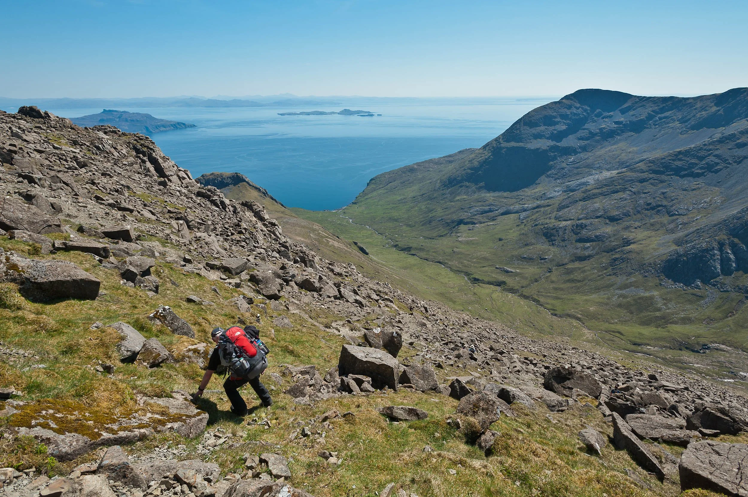
Bill Snee descending from Askival into Glen Dibidil on route to Dibidil Bothy on the Isle of Rum
The Isle of Rum is a National Nature Reserve and a Site of Special Scientific Interest (SSSI). There are no roads on the island and reaching it involves a boat trip, adding to the feeling of an adventure. The jewel of the island for walkers and climbers is the Rum Cuillin, which, like their counterpart, the Black Cuillin on the Isle of Skye, offers excellent rock scrambling along narrow ridges to mountain summits jutting above the Sea of the Hebrides, with great views out to the Atlantic Ocean.
The highlights of my visits to Rum have been hillwalking and backpacking trips on Ainshval and Askival, two of Rum's Corbetts. Although only c.2,500ft high, the view from both peaks is spectacular - a 360 degree view taking in Skye, Eigg, Muick, Canna, the Hebrides and much of Scotland's mainland west coast. On one occasion, on a sweltering bank holiday weekend in May, we bivvied on Ainshval's summit during an epic 3-day expedition where we climbed all Rum's hills, soaking in the heat and the views as the sun set as a fiery orange ball on the horizon. On another trip, pouring rain caused us to bail on a traverse of the Cuillin ridge into the Atlantic Corrie, a gigantic, amazing amphitheatre filled with seemingly no less giant stags that stood their ground and defiantly roared at us as we interrupted their rutting season.
Fortunately, my ratio of good days on the island outweighs the bad days. This includes the day we descended from Askival (pictured), after a brilliant Summer's day's hillwalking, which culminated in an engaging night making new friends at Dibidil bothy on the shoreline.
Getting there and around
Caledonian MacBrayne (www.calmac.co.uk) and Arisaig Marine (www.arisaig.co.uk) both offer easiest access to the island, via their ferry service. For venturing thereon in, you'll need to don your walking shoes. If heading anywhere remote, take standard hillwalking gear (e.g. warm clothes, waterproofs and gloves) plus be experienced in the use of a map (OS Landranger 39) and a compass.
Places to stay
The 'capital' of Rum, Kinloch, has an organised campsite plus cabins for hire. The Isle of Rum Community Trust operates a bunkhouse. Wild camping is an option all over the island (as long as you follow the Scottish Outdoor Access Code). Alternatively, choose to go basic and stay at one (or both) of the island's two mountain bothies - Dibidil bothy and Guirdil bothy). Read more about your options on the island's great website – www.isleofrum.com.

Weekend Wonder - Lochnagar’s mighty cliffs
An opportunity, perhaps. to see the Royal Family on Lochnagar, a Munro in Cairngorms National Park, Scotland.

Alex Haken backpacking along the top of the summit cliffs of Lochnagar,
Lochnagar, a 1155m high Munro in the Cairngorms National Park in Scotland, is a mountain with royal connections. The peak, located nearby Balmoral Castle, is the summer home of the Queen and the Queen's first son, Prince Charles, has been known to climb the hill when the family is in residence.
I had made two attempts to climb Lochnagar before this image was taken. Both times were in the depths of winter and on neither occasion did I meet another soul on the hill, royal or not. On my first attempt, I didn't get past the bealach beneath Meikle Pap, regularly unable to stand on two feet due to strong winds, and on my return I was thwarted at Cac Carn Mor, a giant cairn on the plateau at 1150m, just 5m shy of summit height but 0.5km away of the true summit, Cac Carn Beag. Not because it is slightly confusing (I believe a Mor is 'bigger' than a Beag so you would be forgiven for thinking it would be the summit) but again because of the weather. Great gusts of wind that had built speed over the surrounding rolling hills swept across the plateau and threatened to launch me off the top of Lochnagar's spectacular cliffs. These cliffs, some 200m high in places, hold lots of summer rock climbs and winter ice climbs. I don't believe they are appropriate for base jumping (even with a parachute) so, after a few calls that were too close for comfort, I half walked half crab-crawled my way back to the relative shelter of the approach path and returned with a friend in more amenable weather.
Getting there and around
Lochnagar is usually climbed as a day trip from the Spittal of Glenmuick. For added spice, head in from the North near Invercauld Bridge on the A93 Ballater to Braemar road and climb the great Stuic Buttress, a grade 1 scramble that takes you out onto the plateau near the summit of Carn ' Choire Bhoideach. From there, it's a simple 2km stroll across the plateau to Lochnagar. Alternatively, to enjoy the peak during an overnight trip, walk along the shores of Loch Muick and camp beneath the great cliffs near the Dubh Loch. You can tick off four Munros as you make your way back across the plateau to Cac Carn Beag and your fifth Munro of the day.

Weekend Wonder - Winter hiking on Streap
It’s not all about Munros. Winter hillwalking on a Corbett in the West Highlands of Scotland.

David Hetherington traverses a snowy ridge on Streap in the West Highlands of Scotland
My first sighting of Streap, a superb, 909m high Corbett in the West Highlands of Scotland, was on a 6-day backpacking adventure in 2010 from Glen Shiel to Glenfinnan, when a friend and I followed part of Scotland's epic Cape Wrath Trail. After I returned home, a paragraph in Ralph Storer's classic book, '100 Best Routes on Scottish Mountains', which highlighted Streap's narrow summit ridge "should be left well alone by the inexperienced" continued to intrigue me over the years.
In February 2016, I finally organised a visit to Streap. The weather forecast was excellent and we spent a great two nights in Gleann Dubh-Lighe bothy, trekking on snow-covered slopes through the day beneath a clear blue sky in temperatures that remained, pleasantly, well below freezing.
Ralph Storer was right. In poor weather, you'll need top-notch navigation skills to steer yourself through Streap's complex, craggy bluffs and its steep-sided, narrow arete demands caution all the way to the summit. On a nice day, the difficulties are slight and the ridge is simply awesome, with just the right amount of awkward terrain to keep your interest and incredible views - south-east to Ben Nevis and north-west out to the islands of Eigg, Rum and the Skye Cuillin.
Streap is an outstanding hill. We paired it up with an ascent of Streap Comhlaidh and another Corbett, Braigh nan Uamhachan, completing a round trip of ‘feet in front of the bothy fire’ to 'feet in front of the bothy fire’ of 12 hours (our slowness in part due to being hampered by deep snow). In Winter or Summer, you should find it's an excellent day out.
How to get there
Take a train, bus or car from Fort William to Glenfinnan. Roughly 3km south-east of Glenfinnan, just west of the bridge over the Dubh-Lighe river, a turn-off north leads uphill to a small public car park. From here, OS Landranger map 40 (Mallaig & Glenfinnan, Loch Shiel) and OS Explorer map 398 (Loch Morar & Mallaig) both cover the approach to Streap via the quiet highland glen, Gleann Dubh-Lighe.
Where to stay
Fort William and Corpach are obvious choices. Glenfinnan has a quirky bunkhouse - check out www.glenfinnanstationmuseum.co.uk. If you’re looking for more rustic accommodation, the bothy in Gleann Dubh-Lighe is maintained by the Mountain Bothy Association (www.mountainbothies.org.uk). In 2011, the building was accidentally burnt down when a leaky gas cartridge caught fire. In 2013, it was rebuilt by MBA volunteers.
Weekend Wonder - Backpacking Tranter’s Round
A feature on walking and backpacking Tranter's Round in the West Highlands of Scotland.

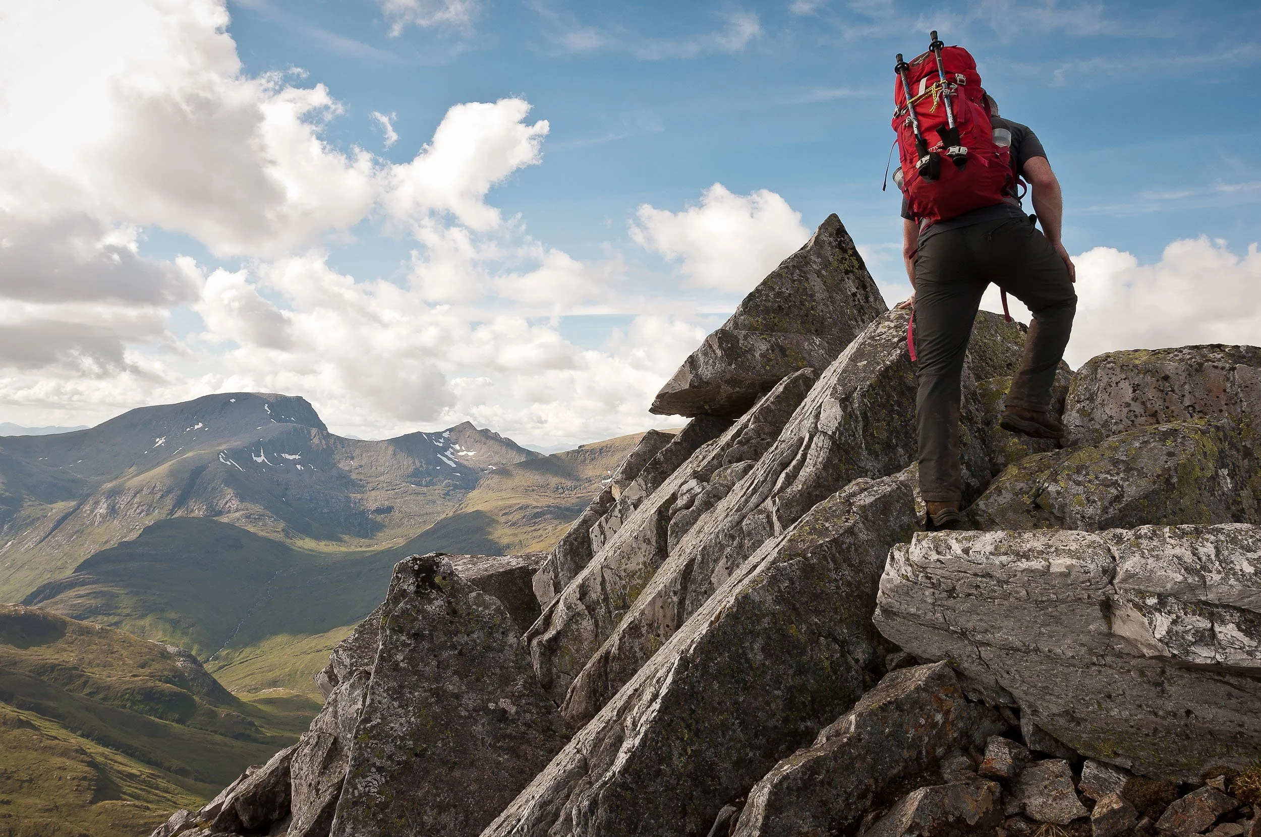
David Hetherington on Binnein Mor in the Mamores, West Highlands of Scotland
A natural progression if you enjoy backpacking trips is to look for opportunities to link different routes together, increasing length and difficulty to set yourself a challenge. One such opportunity is Tranter's Round in the Lochaber region of Scotland.
Tranter's Round is named after Philip Tranter, son of the Scottish author, Nigel Tranter, who in 1964 devised a 24-hour challenge for fell runners when he connected (at the time) 19 Munros in the West Highlands of Scotland (the Mamores, Grey Corries, Aonach Mor and Aonach Beag, Carn Mor Dearg and Ben Nevis) in a 36-mile epic that covers 20,600ft of ascent. Tranter's Round is a fell runner's classic (superseded these days in terms of difficulty by a longer Charlie Ramsay Round, and with a demoted Munro) but it's a route that's also tailor made for backpacking.
To give us a head start on our attempt at backpacking Tranter's Round, we bivvied on a damp summit of Mullach nan Coirean in the Mamores at 2300 hours. Early the next morning, we continued over the Mamores, ticking off the peaks of Stob Ban, Sgurr a'Mhaim and Am Bodach. I didn't go out to An Gearanach, choosing to dry my sleeping bag in the sunshine instead, but Na Gruagaichean soon came next, then Binnein Mor, Binnean Beag and Sgurr Eilde Mor. Sixteen hours after we started out we descended and spent the night at Meanach bothy, having climbed 10 Munros.
Our return leg on day two is commonly called the Lochaber Traverse. First we ticked off the Grey Corries, starting with Stob Ban then Stob Choire Claurigh, Stob Coire nan Laoigh and Sgurr Choinnich Mor. A steep, grassy scramble then took us up onto a very wintry Aonach Beag. It was here that we decided to cut our trip short. A storm that had been distant for much of the afternoon brought in 50mph winds and freezing rain and, in true Scottish style, what had been a pleasant Summer's day turned distinctly nasty with a great risk of hypothermia. None of us are new to bad weather but with eight hours in, three Munros to do (including Britain's highest mountain) and a sharp scrambly ridge between them, it wasn't hard to make the decision to bail over Aonach Mor and descend to the roadside. Despite our disappointment, it was a great outdoor trip. Tranter's Round proved to be a very worthy backpacking route.
Travelling light
The current fastest known time for Tranter's Round, set on 01 June 2024, is 8 hours 27 minutes 53 seconds by Fort William-based GP, Finlay Wild. Although such a fast time will be unachievable (or undesirable) for most, adopting a hill running ethos for backpacking Tranter's Round isn't a bad idea. Travelling with as little gear as possible will be easier on your knees.
Navigation
Harvey Maps publish a map for the Charlie Ramsay Round, which includes the same peaks and is ideal for Tranter's Round. The route is also covered on Ordnance Survey Landranger map 41 (Ben Nevis, including Fort William & Glen Coe). You can choose to go clockwise or anti-clockwise. The latter has the distinction of finishing on Britain's highest mountain.

Weekend wonder - Creach Bheinn
Ascending the Corbett Creach Bheinn near Oban, submitted as part of a regular Weekend Wonder feature in Adventure Travel magazine.

Looking over to Ben Starav from the frozen snow slopes of Creach Bheinn in the West Highlands of Scotland.
Despite the number of years I’ve spent walking and scrambling in Scotland’s hills, I’ve always been excited when making plans to visit a new location. Researching different ways for how I can ascend a mountain gives me an opportunity to consider what’s around the area and establish whether I’ll be able to see familiar hills nearby from a different perspective.
An example of this was an ascent we made of Creach Bheinn, a Corbett near Oban in the West Highlands of Scotland. I’ve climbed its neighbour, the Munro Beinn Sgulaird, multiple times but it wasn’t until the prompting of a friend who is completing his Corbetts that I showed any interest in Creach Bheinn. We were based in Oban for the weekend and I was due to catch up with other friends of mine who were visiting from Alaska. They’d never been on a Scottish hill before so the obvious choice was to take them up a Munro. Our plan was we would climb Beinn Sgulaird first and extend our day to include Creach Bheinn. Unfortunately (okay, not really) we had great weather and the number of extended stops we made for photographs meant we ran out of time and we agreed to return the following day.
In the morning, our good fortune with the weather had continued. The steep ascent from Loch Creran to the bealach at the head of Coire Buidhe passed quickly and the views we had during our ascent to Creag Bheinn’s summit were superlative. At the summit trig point, if we faced West and turned clockwise we could see over the sea to the Isle of Mull. In a northerly direction, there was Ardgour and Ben Nevis plus expansive views further East, all the way inland to the Tyndrum hills. Further south, we had great views into the back of the Ben Cruachan group but perhaps our best view was north-east to Glen Etive, where we could see all the way down the glen towards Glencoe and Buachaille Etive Mor. I’m no stranger to Glen Etive, having visited it on many an occasion when I’ve climbed the Munro, Ben Starav, but I’ve always entered the glen from its northern end. The view we had of Ben Starav during our descent of Creach Bheinn was from across the southern end of the glen, over the head of Loch Etive. I'd never seen Ben Starav from this perspective and I wasn’t aware of the obvious rock buttresses that sit right beneath its summit. They reminded me of the mighty Triple Buttress on another Scottish Munro, Beinn Eighe.
Getting there and around
Oban is easily accessible from Glasgow, either by rail (www.scotrail.co.uk) or by car (head to Tyndrum on the A82 and then west on the A85). Creach Bheinn is only really accessible by car. From Oban, drive the A85 north to Connell and cross the bridge to Benderloch. Continue on the A85 to South Creagan and, before you cross the bridge, turn left at the roundabout and follow the road along the south shore of Loch Creran to reach Druimnavuic. From there, you’ll want to switch into standard hillwalking gear (e.g. warm clothes, waterproofs and gloves) plus be experienced in the use of a map (Ordnance Survey Explorer 377 Loch Etive & Glen Orchy) and a compass.
Places to stay
Oban has plenty of options for accommodation, from B&Bs and hotels to a Youth Hostel with great sea views (www.syha.org.uk). For longer stays, consider Bonawe Holiday Cottages near Taynuilt (www.bonawehouse.co.uk). These self-catering cottages are owned and managed by a former long-standing team leader of Oban Mountain Rescue Team.

Weekend wonder - Snowdon scrambles
Two scrambling options in Snowdonia National Park, published as a Weekend Wonder in Adventure Travel magazine.
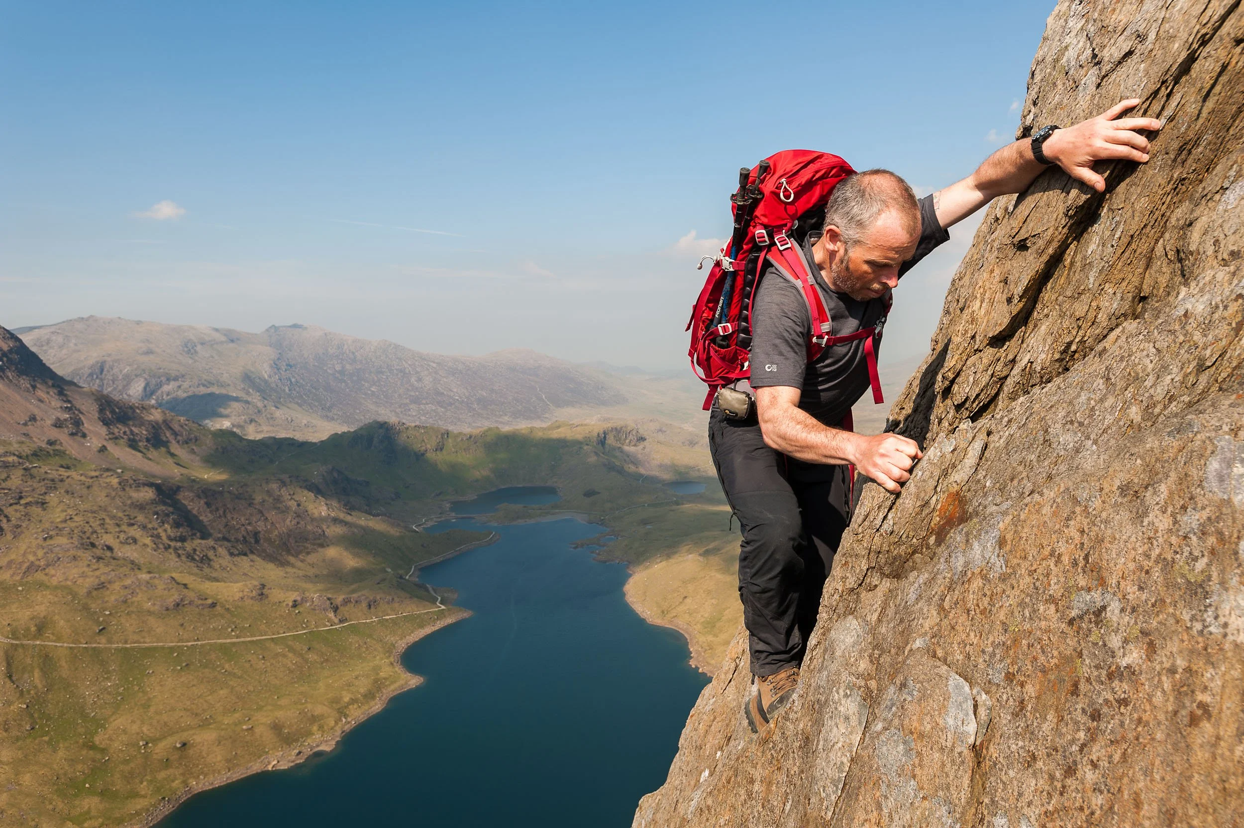
David Hetherington scrambling on rocky slabs high above Llyn Llydaw during an ascent of Y Lliwedd on the Snowdon Horseshoe.
Living in Edinburgh, my built-in compass usually sees me heading north when I have time off - Scotland’s hills are very hard to resist - and I've headed south in the UK only twice before. Thick mist and rain one November spoiled the view for us in the Lake District and at times we counted ourselves lucky we could even see each other on the hill. On my second trip, we spent 3 days walking and scrambling with friends in Wales in Snowdonia National Park. Thankfully, there was no rain forecast and we expected 25 degree C temperatures.
Snowdonia National Park is a perfect place to visit for mountain walking, especially if you’d like to test your scrambling skills. Early on in my hiking and backpacking ‘career’, I had a bad experience whilst scrambling. I can’t recall which mountain I was on but I was in the North-West Highlands of Scotland and I clearly recall being stuck on the side of a ridge in a position where I didn’t want to go up and I didn’t want to go down. Numerous attempts at alleviating the situation failed and I had my first (and only) experience of ‘sewing machine leg’ where your leg involuntarily shakes and you feel like you are going to fall off the mountain. On that occasion, I was gratefully assisted by a friend physically moving my foot to an unseen foothold but it set in motion for me a somewhat irrational fear I have of falling when I’m on technical ground. Since then, I’ve often been wary of putting myself into exposed situations but I do love the visual aspect of a mountain ridge and scrambling along one is as fine a way as any to reach or descend from the summit of a mountain.
We started our Welsh trip with a scramble around the Snowdon horseshoe. This classic route traverses the excellent Crib Goch, at times a knife-edge ridge that led us to the summit of Yr Wyddfa, or Snowdon, Wales’ highest mountain. The horseshoe continues over Y Lliwedd and returns you to Pen y Pass. It’s a long day out but you’re almost guaranteed peace and quiet once you’ve left behind the drama of the number of people on Snowdon’s summit. The next day we drove round to the beautiful Ogwen Valley and climbed the north ridge of Tryfan, a route that the British Mountaineering Council calls ‘a long and thrilling grade one scramble that makes a perfect introduction to the sport’. On the summit, the brave can leap from two large rocks called Adam to Eve to test their mettle even further. We continued over the spectacularly spiked rocks of Glyder Fach to Glyder Fawr before we descended a really fun route on Y Gribin. This entertaining ridge, which led us back to our car via a refreshing mountain lake, provided us with great views back to the route we’d descended off Tryfan.
Looking after yourself
Snowdonia National Park is covered by Ordnance Survey Explorer Snowdonia map set - OS Explorer Maps OL17 / OL18 / OL23. If you’re nervous about scrambling on your own, or with friends, consider a training course. You can learn the skills safely before venturing onto technical terrain. Plas Y Brenin (http://www.pyb.co.uk) is the national mountain sports centre and is located in Snowdonia National Park just outside Capel Curig.

Weekend wonder - Ladhar Bheinn, Knoydart
A summary of the Munro Ladhar Bheinn in Knoydart, published as a ‘Weekend Wonder’ feature in Adventure Travel magazine.

Scrambling the south-east ridge of Ladhar Bheinn, with Coire Dhorrcail on the right
Ladhar Bheinn is one of my favourite Scottish mountains – partly because it is only accessible by boat or by foot. Getting there usually involves travelling 9km by boat from Mallaig to the small settlement of Inverie (popularly known as the home of Scotland's most remote mainland pub) or hiking around 13km of rough terrain from Kinloch Hourn, itself accessed via 35km drive along a single-track road.
I’m not a person of the mind that once a hill is climbed it's ticked off. Some hills deserve repeat ascents and I like to approach them from different sides and take time to explore the mountain. My first ascent of Ladhar Bheinn was from Inverie. We'd headed for Mam Barrisdale before breaking off up steep, fern-covered slopes onto the curious feature split ridge of Aonach Sgoilte. My second was during a four-day backpack of all the Munros in Knoydart, when we reached Aonach Sgoilte after first climbing two nearby Corbetts, Beinn na Caillich and Sgurr Coire Choinnichean. Both visits were in excellent weather and we savoured the warmth of the sun and some great views as we scrambled up the north-west ridge of Ladhar Bheinn to its summit.
My last visit to Ladhar Bheinn was in 2017 (Edit - I’ve been back three times since). Clad in waterproofs, hat and gloves to combat the cold Spring weather, we hiked the classic route up the mountain, a route which navigates the horseshoe-shaped rim of Coire Dhorrcail. The headwall of this great mountain corrie is ringed with crags and enclosed by two great, narrow, steep-sided ridges, Stob a' Chearcaill and Stob a’ Choire Odhair. Although the Knoydart peninsula is known as the 'rough bounds' for the wild nature of its terrain, the ground isn't too challenging and we gained height quickly ."What an awesome location", I recall saying as we crested the corrie headwall and broke out onto Ladhar Bheinn's north-west ridge.
Ladhar Bheinn's summit flanks provide a fantastic viewpoint. As well as the views over Loch Hourn, you can see south-east to the neighbouring Munros, Luinne Bheinn and Meall Bhuide, and west out over the Corbett of Sgurr Coire Choinnichean towards Mallaig. Ladhar Bheinn's rocky north-west ridge is also great fun, with a few Grade 1 scrambling opportunities but nothing overly technical or exposed. There's also the opportunity to stand on an obvious prow of rock halfway up that overhangs a drop of several hundred feet and has great views down Loch Hourn. It's quite a special place.
Getting there
Take the train, bus or drive from Fort William to Mallaig. A ferry at the port (www.calmac.co.uk and others) will sail you across the lower Sound of Sleat to Inverie. Alternatively, drive the A82 from Fort William and head for Invergarry. Turn onto the A87 and, not long after, follow the singletrack road west past Loch Garry and Loch Quoich to reach Kinloch Hourn. From here there’s a long, rough walk in to Barisdale Bay which provides access to Ladhar Bheinn or you could sea kayak in, like I did once on this sea kayaking and hillwalking trip in Knoydart.
Where to stay
Outside the comforts of Inverie (where you'll find B&Bs, a hotel and bunkhouse plus luxury self-catering accommodation), there are three overnight options for climbing Ladhar Bheinn. You can wild camp almost anywhere, courtesy of Scotland's refreshing outdoor access code, or stay in one of two private bothies nearby, Barisdale bothy or Druim bothy. Neither is maintained by the Mountain Bothy Association and both charge a fee for accommodation, with Druim requiring booking in advance.
More information: http://www.visitknoydart.co.uk
Map: OS 1:50,000 Landranger sheet 33 (Loch Alsh, Glen Shiel and Loch Hourn)

Paul Tattersall - Mountain running
A mountain running photo shoot with professional mountain guide and climber Paul Tattersall in Torridon, Scotland.
Paul Tattersall is a renowned climber, mountain guide and outdoor safety expert who lives just outside Gairloch in the North-West Highlands of Scotland. The first person I know to have completed a double traverse of the highly technical Black Cuillin Ridge on the Isle of Skye, Paul has also ran all the Torridon Munros (Scottish mountains over 3,000ft / 914.4m high) in one day, plus, when he was younger, completed all 282 Munros whilst riding or carrying a mountain bike to each summit. This photo set is of Paul running on two of Scotland’s Munros, Beinn Eighe and Liathach in Torridon. You can find out more about Paul at www.gofurtherscotland.co.uk.


Mountain landscapes - Lochaber, Scotland
Mountain landscape photography showcasing the summits and ridges in the Glen Coe, Glen Etive, and Glen Nevis regions of Lochaber in the North-West Highlands of Scotland.
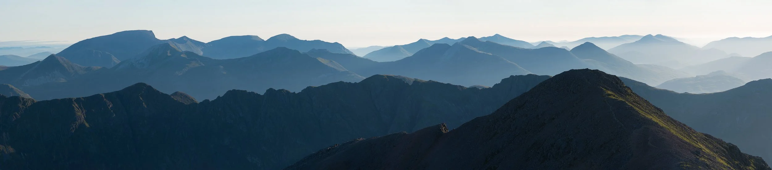
Lochaber is a region in the West Highlands of Scotland that is home to many of Scotland’s finest Munros, including the UK’s highest peak, Ben Nevis, its mighty neighbours (the 4,000ft+ peaks of Carn Mor Dearg, Aonach Mor and Aonach Beag and the Great Corries) and the slightly lower but no less aesthetically-pleasing (and backpacker’s delight) Mamores. Further south, the interest for walkers and climbers continues as the steep-sided hillsides and ridges continue above the glacier-gouged glens of Glen Coe and Glen Etive, home to more classic Munros such as Meall Dearg and Sgòrr nam Fiannaidh (challengingly located at either end of Aonach Eagach, perhaps the UK mainland’s trickiest mountain ridge), the huge bulk of the Bidean nam Bian massif, plus Ben Starav, a not quite as big but still a no less-fine Munro that is guarded by what I imagine to be one of the most well-loved Munros of all, Buachaille Etive Mor, aka the ‘Big Herdsman of the Etive’. What follows is a selection of images showcasing the mountain views across the landscape of Lochaber in Scotland, many taken from the summit of just one Munro, Bidean nam Bian, and its satellite peaks, Stob Coire nan Lochan and Stob Coire nam Beith.